I’m just about due for an update. It’s Semana Santa here in Latin America, or Holy Week. A year ago I was headed south to Nicaragua for some beach time. This year I’m nestled into my Guatemalan city with zero travel plans. In all actuality, every day that I’m in Guatemala constitutes as a travel day in my opinion. I’ve found a coffee shop facing the park that has a comfortable Starbucks-esque feel to it. Apparently the other gringos feel the same way because this place is buzzing with them. I have a small table facing large floor to ceiling windows, probably formerly doors, that overlook the park. The sun is shining and I can see people leisurely strolling along. I’d guess that the temperature is roughy perfect degrees Fahrenheit. The forecast today includes perfect with perfect accumulating later in the day, which will lead the way to perfect skies tonight.
Let’s backtrack a little.
Journal entry 4 days after arriving in Guatemala:
Much of Guatemala has left my eyes glazed with wonder. This country has a synonym: Green. I love it. I just love it. Green green everywhere. The roads carve through the mountains in ways that shouldn’t be legal. Switchbacks cut and carve steeply in ways that makes trucks tortuga (spanish word for turtle) along as if they’re standing still. And it’s not bits and pieces. It goes on and on. Lush green thickly lines the roadways only allowing breaks to expose vast expanses of more lush green vegetation growing off colossal hillsides and steep mountain cliffs. I want to stop and take photo after photo but I always return home to find that the same image on my screen barely scratches the surface when trying to recompose the feeling of standing there in awe. Perhaps it’s the climate, the smell that envelops you and allows your mind to drift into enchantment. Having a bike here has been one of the best decisions of my lifetime.


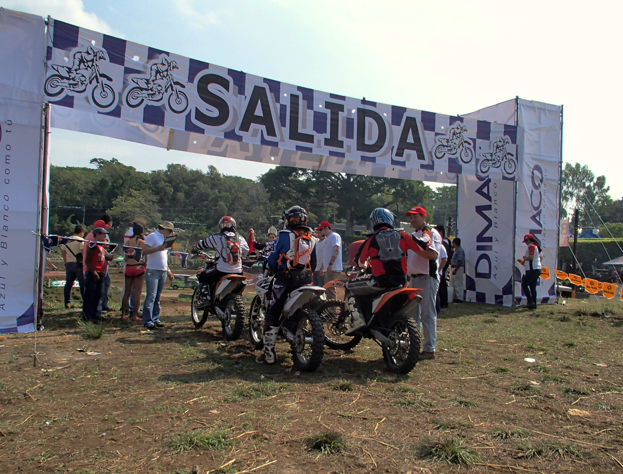
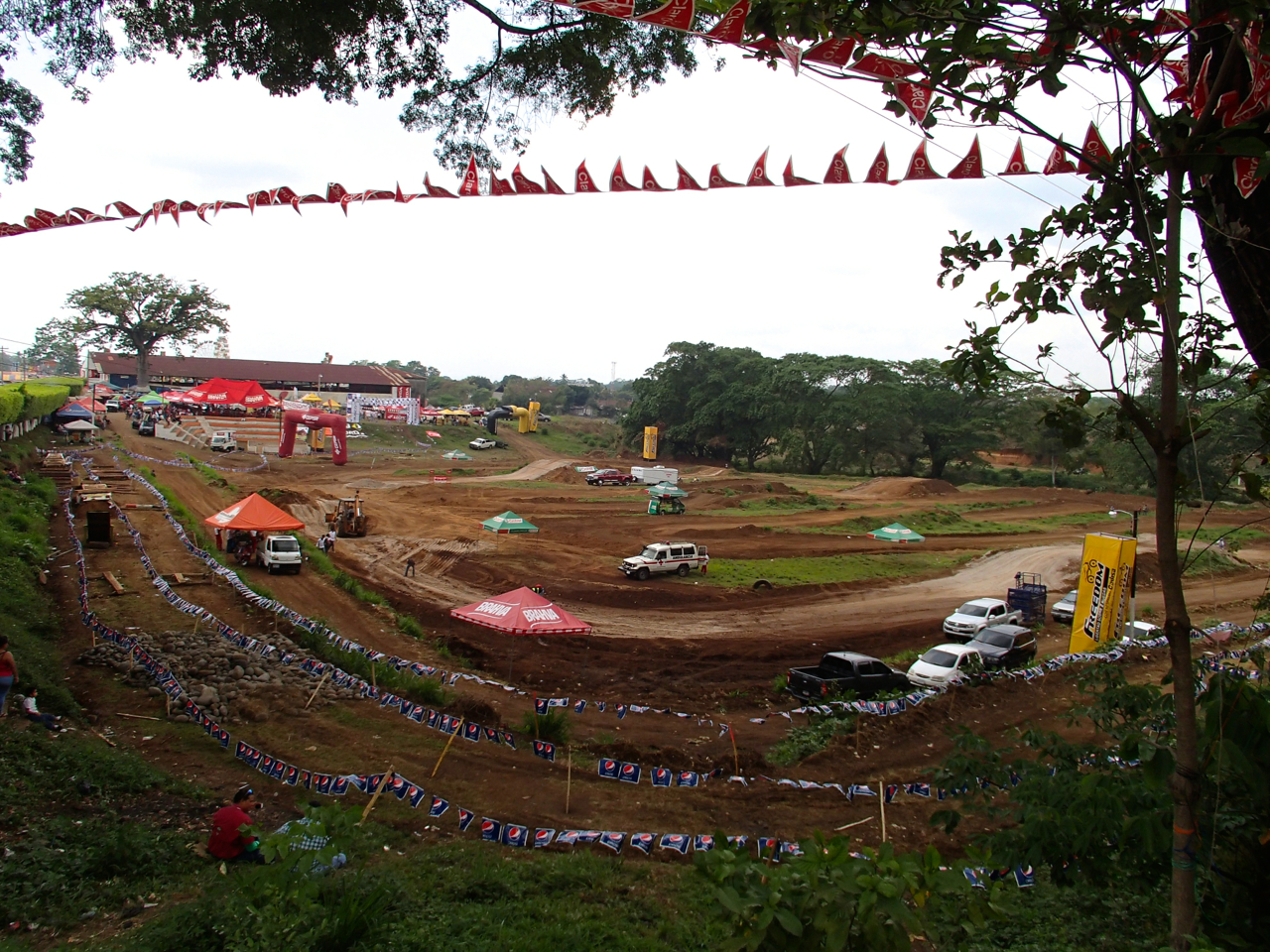
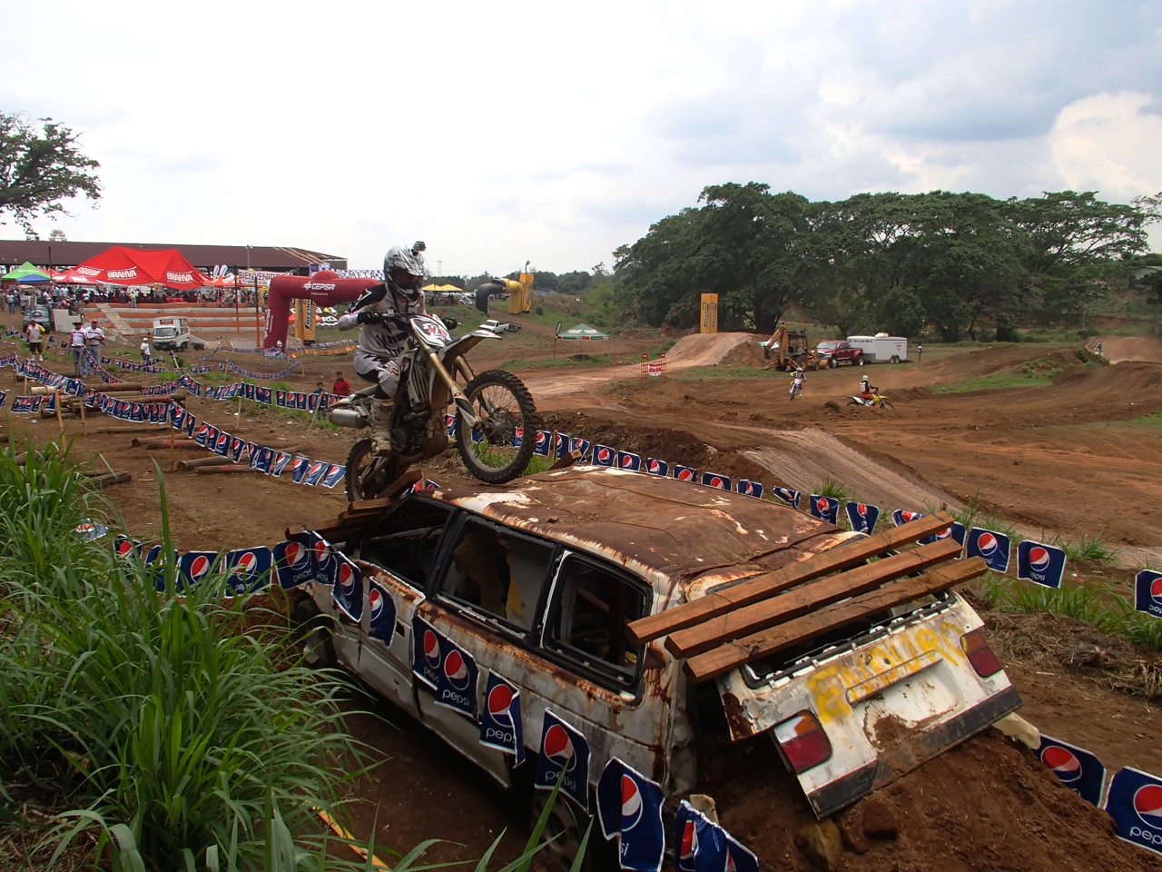
I arrived in town on a Thursday and was immediately faced with the business. An endurance motocross rally hybrid race was scheduled to come to Xela that weekend, so I was obliged to check it out. It was my first time seeing that kind of racing live and it left me wondering if there is more than one man of steel in this universe. Men of steel. Clawing, churning, dragging, lifting, pushing, pulling, slamming, dropping, running. Anything it took to get that bike across those boulders, those tree trunks, as fast as humanly possible, all the while wearing full kit in the hot midday sun. The Dakar Rally must be an incredible sight. Time to add that to the short list. As luck would have it, the circuit continued at another location a few hours south of me the following weekend. I found out about the second race when I brought the KTM to a local mechanic to inquire about a clutch fix. Ivan, one of the racers in this racing circuit (riding a KTM), had a new clutch ordered, delivered and installed in my bike in 3 days. The bike immediately felt 100% better. We shook hands and I told him I’d see him on race day. As it turns out, Ivan is in the upper tier of riders. His bike was well worn in comparison with some of the other racers with the shiny new kit, but when it came time to rip across three foot log pyramids and boulder sections, Ivan was the business.


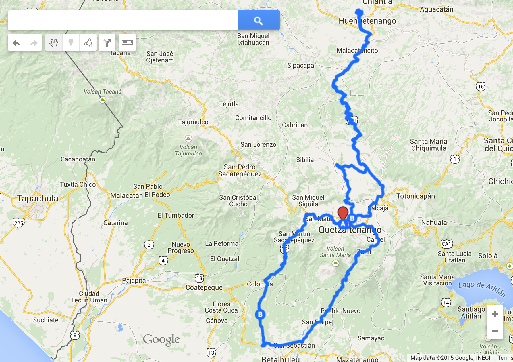
Since arriving in Guatemala I’ve been slowly switching gears. What’s the rush? Monday through Friday is largely consumed with learning Spanish. By the end of each 5 hour, one-on-one, day, my head is swimming with verbs and conjugations. After lunch I’m free to study, read, walk, ride, plan weekend adventure routes to Maya sites or nap. Life is tough. After being jazzed up by moto-enduro, this guy was ready to do some exploring. I adjusted the suspension of my steed for lightweight travel, cleaned up my suit and bought a guide book. Tak’alik Ab’aj, a two thousand year old Maya site, was two hours to the south, with a direct route indicated by a questionably thin yellow line riding along the crests and valleys of a few mountains. Often those kinds of lines are indicated by Google Maps suggesting that the possibility of something resembling a road could exist in that general area. Option B would be loop southwest and then back north along the road I had ridden the day before for moto enduro. Boring. No thanks.
Journal notes from the trip:
I went to Tak’alik Ab’aj this weekend. Yesterday, actually. It was cold leaving at noon. I wore my coat and by the time I got halfway there I was peeling. Big elevation drop. I decided to be a bit adventurous and follow a smallish yellow line on my Nat-Geo map. The road was confirmed by Google Maps and it clearly went through the mountains. I imagined that it would be somewhat Honduras like, perhaps I’d pass a few villages on a dirt road. It was quite a bit different. The cobbles that led out the back door of a nearby pueblo on the main roadway stayed cobbles for a majority of the trip. I found people walking on it for a small part of the time, but mostly I was the only person cobbling along. My legs are still a little store from standing on the pegs for so long. I was using my quads in a way that I haven’t in some time. It was kind of fun and kind of not as great as sitting once the novelty wore off. I suppose a slimmer tank bag, bar risers and wider foot pegs would have made the whole experience better. Live and learn. What I would also soon find out is that my beginning-to-flatten-out Pirelli Scorpions do not have much grip in the dirt. I passed through some forgotten towns and turned off for what I was almost certain was the left turn for Tak’alik. The road dove sharply and 50 feet or so on the decline was a large gate blocking any entry. Turn around.
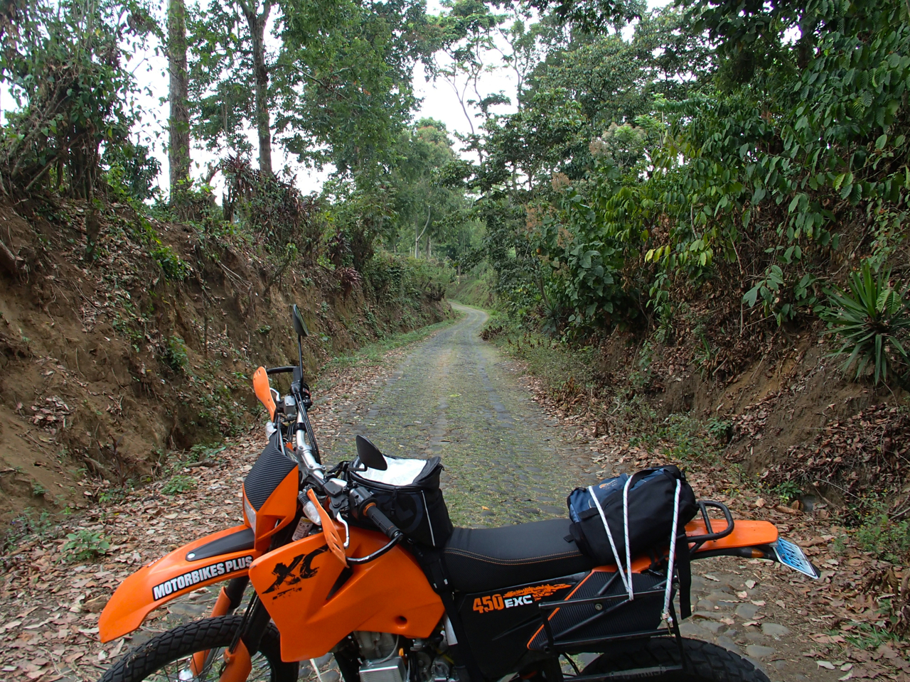
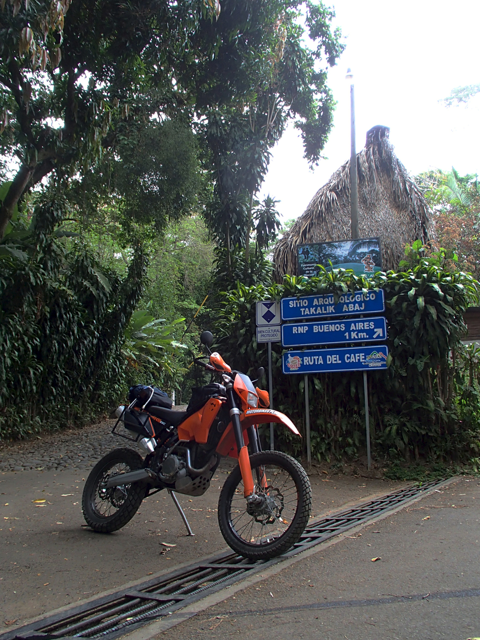
I assumed that my mapping was a little off and I needed to push on a little more. The road became dirt with very uneven tracks, the left hand being a good 7-10 inches lower than the right. It was wide enough for a vehicle and a few minutes down the road I came across a parked truck with some kind looking farmers hanging around it. They allowed me to ride past with just enough room and 10 feet later my rear tire slid into the lower track, pointing my front up the incline to the right. I gassed it and poom! the bike tried to run up the hill. I managed to stay on it without falling but must have looked the right idiot to my new audience. One of the older farmers came by and offered to help. I told him all was well without removing my helmet and asked him if this was the way for Tak’alik. “Oh no, this road disappears! You need to go back and when you see the soccer field, turn right.” I thanked him and wondered about my tires. They’re not so strong on this soil. I backtracked a bit until I hit the cobbles again and then saw the soccer field on my left. I went to turn right and boom, it was the same gated road that I had just turned around at before! Nuts. At that moment two kids were walking. “Excuse me, is this the road for Tak’alik?” “Yeah,” the taller boy gave a lazy wave down the road, “just go down that way.” I parked the bike at the top of the hill and walked down to get a closer second look at this gate. It had a crossbar on two concrete pillars, locked. But, there was a well trodden footpath around one of the pillars with just enough room for the bike to get by. Game on.
The kids had looked at me with wonder as to why I’d want to go that way and it gave me pause. Was there a reason? But then I thought about the kind farmer. He was definitely kind. From an older generation of workers that just wanted to work and enjoy life. How did I gauge all of that in such a short time? Maybe because I’ve come across those kinds of people in my Honduran life. Either way, if there had been any serious danger, I feel that he would have said something like “it’s dangerous to go through there. A group of narco traffickers live there and they will cut you up.” But, he didn’t warn me, so I took that as a sign. I passed the gate and took a few photos.

Completely abandoned. Cobbled tracks wide enough for a vehicle dove steeply into the valley and then climbed briskly like the rest of these Guatemalan roads. I dipped into the valley and as I was climbing I wondered if I was getting myself into trouble. I was in the middle of nowhere on a gated, closed, road and there were absolutely no houses, or farmed land. Nothing. I could be riding into the middle of a narco camp with machine guns and a tank and anti-aircraft weapons. Really. It’s Guatemala. Anything is possible. Looking back I don’t feel like it was foolish. Maybe I could have asked the old man if the road was safe, but Guatemalans will ALWAYS err on the side of caution and tell you that something is dangerous. I don’t know if it’s ignorance or over cautiousness. Especially with foreigners. Maybe if he told me that it was dangerous I would have double backed the entire way on those terrible cobbles and gone pavement the long way around. It’s another 45 minutes to loop completely around and come up from the south. But, on the other hand, that road was SO abandoned it could have easily been some kind of camp for a cartel. The lack of any farmlands and houses made me think I could literally be driving up a cartel’s driveway. And my near off just a few minutes before didn’t give me enough confidence to whip the bike around like I had seen the guys do at moto enduro the day before.
With a head filled with fear mixed with excitement, how dumb does that sound, I pushed on. Maybe some gut feeling. I crested a hill and saw a fairly nice house under construction. Actually, a really nice two story house made from concrete. It couldn’t have been more than 30% finished. Sh*t! I AM in narco-land! No way I’m going back down that cobble roller-coaster. No way I could carve that road quickly and a quad or pickup could easily overtake my bike on those slippery cobbles. Time to move forward and see what happens. I rode on and saw a farm, phew. And then another farm. And then I was in the middle of bumble. The cobbles left and pure orange-yellow dirt followed. Poor people. Really poor. They all looked at me like “Hey you, tourist, what are you doing here on your flashy orange bike?” Donnie was right. It doesn’t matter if you have a Rizoma gold handlebar or a stealth black bar on your bike. It doesn’t make a difference if you have $5,000 carbon fiber wheels or spoke rims or “stealth black” paint or day-glow yellow. A big bike is a big bike and it’s clear as black and white. You stand out. End of story.
Ten minutes later I found my destination.
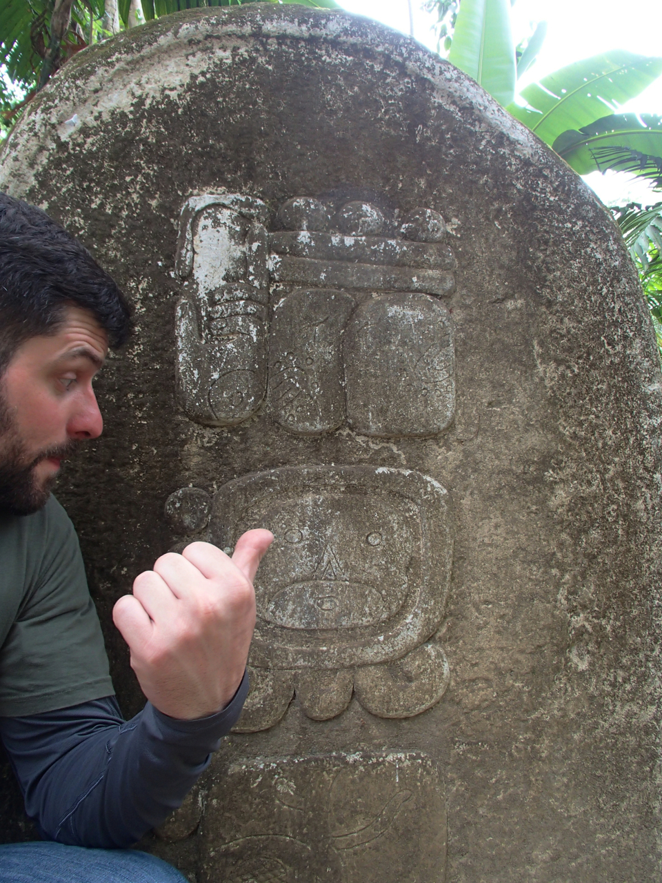

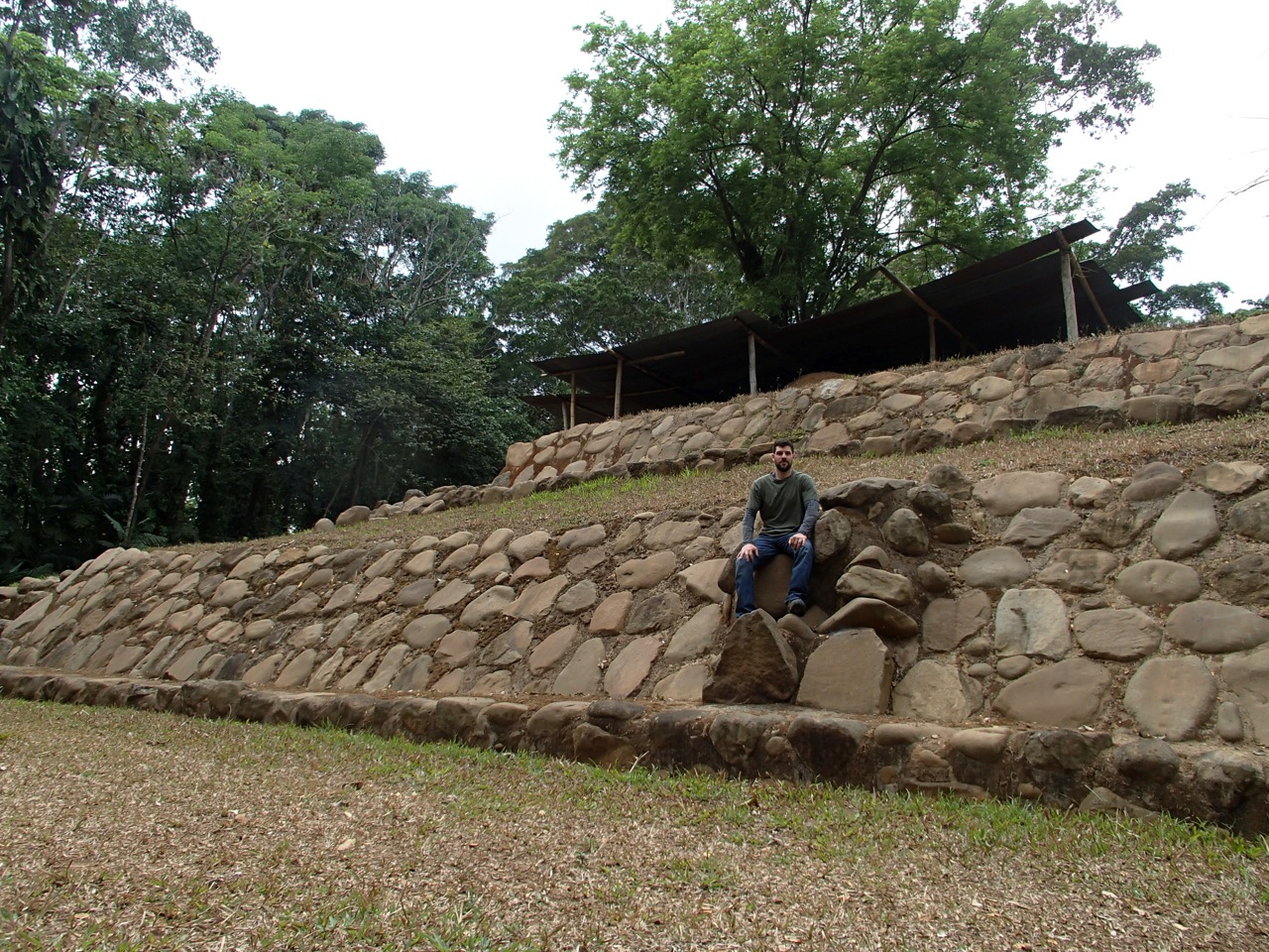
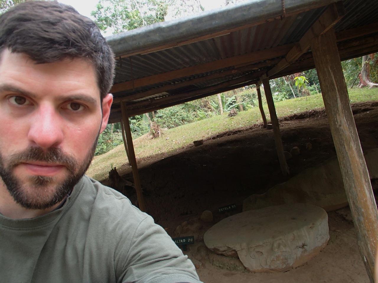
The ruins were mostly washed out. A big disappointment. I had to look at the x-ray type photographs on the information signs to see what was actually going on under the moss. Other statues were almost completely worn smooth by time. I spent some time on Google when I returned home to find out more about this site. Probably something I should have done before I left. There were photos of things that looked almost new, which in no way resembled what I had seen. Oh well. The rest were round stones arranged like sidewalks. The ball court was fairly well preserved and one point of interest was a series of rocks they used, three parallel rows actually, helped them discern lunar calendars and dates. I was looking at the diagram, again a much better copy than the real life lumps sitting in front of me, and discovered that they might have been fairly sophisticated. Their calendar was very accurate.
It was hot and muggy, but I enjoyed it, so long as I kept on moving. The mosquitoes were horrendous. Even DEET Deep Woods didn’t deter these bastards. I climbed where I wasn’t supposed to climb and took a few long sweeping breaths of this violent culture. Sacrifice was not a word you threw around lightly here.


I returned home via the “normal” road, circling east then north. I wasn’t in the mood to stand on my pegs for 45 minutes. The route took me along Santa Maria Volcano and some other volcanoes. I need to return to some of those areas. I cannot describe how incredible the view is. Really. It’s unreal. As if giants were standing there and you only get a glimpse at their humongous toes. The rest, up and beyond, is shrouded in cloud forest and left to the imagination. Truly incredible. I can’t describe it any other way.
Next stop: Parque Arqueológico Zacaleu.

I did the same Greg !: from Xela to Quetzal.
Great !
Have fun amigo.
LikeLike
always glad to hear these adventures after the fact.
LikeLike
Love to ready your writings! So fortunate that I met you in GT and that I get to follow your amazing journeys!
LikeLike
congrats reaching your destination safely! saw your posts on ADVrider, following you here. I like your Interesting observations, well written! cheers, cnflyboy, Ct., USA
LikeLike
Thanks Stephen. Glad you like the blog. I’m gradually migrating the posts to ADV. More to come about Guatemala once I start exploring again. I’ve been laying low for a week. Safe travels.
LikeLike